Map & General Info
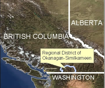
Geographically, the Regional District is bounded by Manning Park to the west, Peachland to the north, Anarchist Mountain to the east and the United States border to the south. The Regional District has an area of 10,400 km2, constituting 1.2% of the province's area.

2000 NOAA (National Oceanic and Atmospheric Administration) Satellite Image (Click on image for a larger version)
Directions to the RDOS Office
Current Demographics

Future Growth
The area's mild climate, scenic environment and wide variety of recreational opportunities continue to attracted many people to the area. The Okanagan-Similkameen Regional District's population is projected to grow by 36% (28,791 additional people) from 79,457 in 2006 to 108,226 by 2031.


